|subdivision_type1 = Governorate
|subdivision_name1 = Idlib Governorate
|subdivision_type2 = District
|subdivision_name2 = Ariha District
|subdivision_type3 = Nahiyah
|subdivision_name3 = Ihsim
| parts_type =
Occupation
| parts_style = para
| p1 = * Hay'at Tahrir al-Sham
|government_type =
|leader_title =
|leader_name =
|established_title =
|established_date =
|established_title2 =
|established_date2 =
|established_title3 =
|established_date3 =
|area_magnitude =
|unit_pref = Metric
|area_footnotes =
|area_total_km2 =
|area_land_km2 =
|area_water_km2 =
|area_total_sq_mi =
|area_land_sq_mi =
|area_water_sq_mi =
|area_water_percent =
|area_urban_km2 =
|area_urban_sq_mi =
|area_metro_km2 =
|area_metro_sq_mi =
|population_as_of = 2004 census
|population_note =
|population_total = 10,353
|population_footnotes =
|timezone = EET
|utc_offset = +2
|timezone_DST = EEST
|utc_offset_DST = +3
|coordinates =
|elevation_footnotes =
|elevation_m =
|postal_code_type =
|postal_code =
|area_code =
|website =
|footnotes =
}}
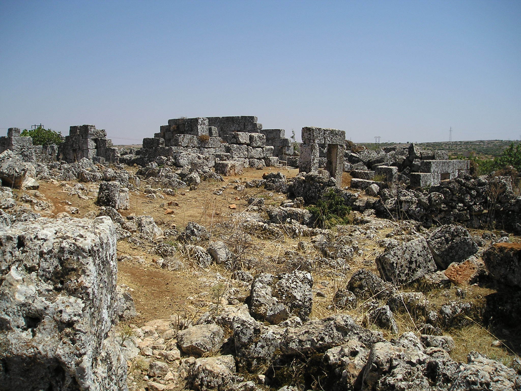
Bara or al-Bara () is one of the former "Dead Cities" in northwestern Syria. It is located in the Zawiya Mountain approximately north from Hama and approx. 80 km southwest from Aleppo. Al-Bara is also a town in Ariha district. According to the Syria Central Bureau of Statistics (CBS), al-Bara had a population of 10,353 in the 2004 census.
Provided by Wikipedia
Showing 1 - 3 results of 3 for search 'Al Bara', query time: 0.02s
Refine Results
 |subdivision_type1 = Governorate
|subdivision_name1 = Idlib Governorate
|subdivision_type2 = District
|subdivision_name2 = Ariha District
|subdivision_type3 = Nahiyah
|subdivision_name3 = Ihsim
| parts_type =
Occupation
| parts_style = para
| p1 = * Hay'at Tahrir al-Sham
|government_type =
|leader_title =
|leader_name =
|established_title =
|established_date =
|established_title2 =
|established_date2 =
|established_title3 =
|established_date3 =
|area_magnitude =
|unit_pref = Metric
|area_footnotes =
|area_total_km2 =
|area_land_km2 =
|area_water_km2 =
|area_total_sq_mi =
|area_land_sq_mi =
|area_water_sq_mi =
|area_water_percent =
|area_urban_km2 =
|area_urban_sq_mi =
|area_metro_km2 =
|area_metro_sq_mi =
|population_as_of = 2004 census
|population_note =
|population_total = 10,353
|population_footnotes =
|timezone = EET
|utc_offset = +2
|timezone_DST = EEST
|utc_offset_DST = +3
|coordinates =
|elevation_footnotes =
|elevation_m =
|postal_code_type =
|postal_code =
|area_code =
|website =
|footnotes =
}}
Bara or al-Bara () is one of the former "Dead Cities" in northwestern Syria. It is located in the Zawiya Mountain approximately north from Hama and approx. 80 km southwest from Aleppo. Al-Bara is also a town in Ariha district. According to the Syria Central Bureau of Statistics (CBS), al-Bara had a population of 10,353 in the 2004 census.
Provided by Wikipedia
|subdivision_type1 = Governorate
|subdivision_name1 = Idlib Governorate
|subdivision_type2 = District
|subdivision_name2 = Ariha District
|subdivision_type3 = Nahiyah
|subdivision_name3 = Ihsim
| parts_type =
Occupation
| parts_style = para
| p1 = * Hay'at Tahrir al-Sham
|government_type =
|leader_title =
|leader_name =
|established_title =
|established_date =
|established_title2 =
|established_date2 =
|established_title3 =
|established_date3 =
|area_magnitude =
|unit_pref = Metric
|area_footnotes =
|area_total_km2 =
|area_land_km2 =
|area_water_km2 =
|area_total_sq_mi =
|area_land_sq_mi =
|area_water_sq_mi =
|area_water_percent =
|area_urban_km2 =
|area_urban_sq_mi =
|area_metro_km2 =
|area_metro_sq_mi =
|population_as_of = 2004 census
|population_note =
|population_total = 10,353
|population_footnotes =
|timezone = EET
|utc_offset = +2
|timezone_DST = EEST
|utc_offset_DST = +3
|coordinates =
|elevation_footnotes =
|elevation_m =
|postal_code_type =
|postal_code =
|area_code =
|website =
|footnotes =
}}
Bara or al-Bara () is one of the former "Dead Cities" in northwestern Syria. It is located in the Zawiya Mountain approximately north from Hama and approx. 80 km southwest from Aleppo. Al-Bara is also a town in Ariha district. According to the Syria Central Bureau of Statistics (CBS), al-Bara had a population of 10,353 in the 2004 census.
Provided by Wikipedia